By Amy Fowler
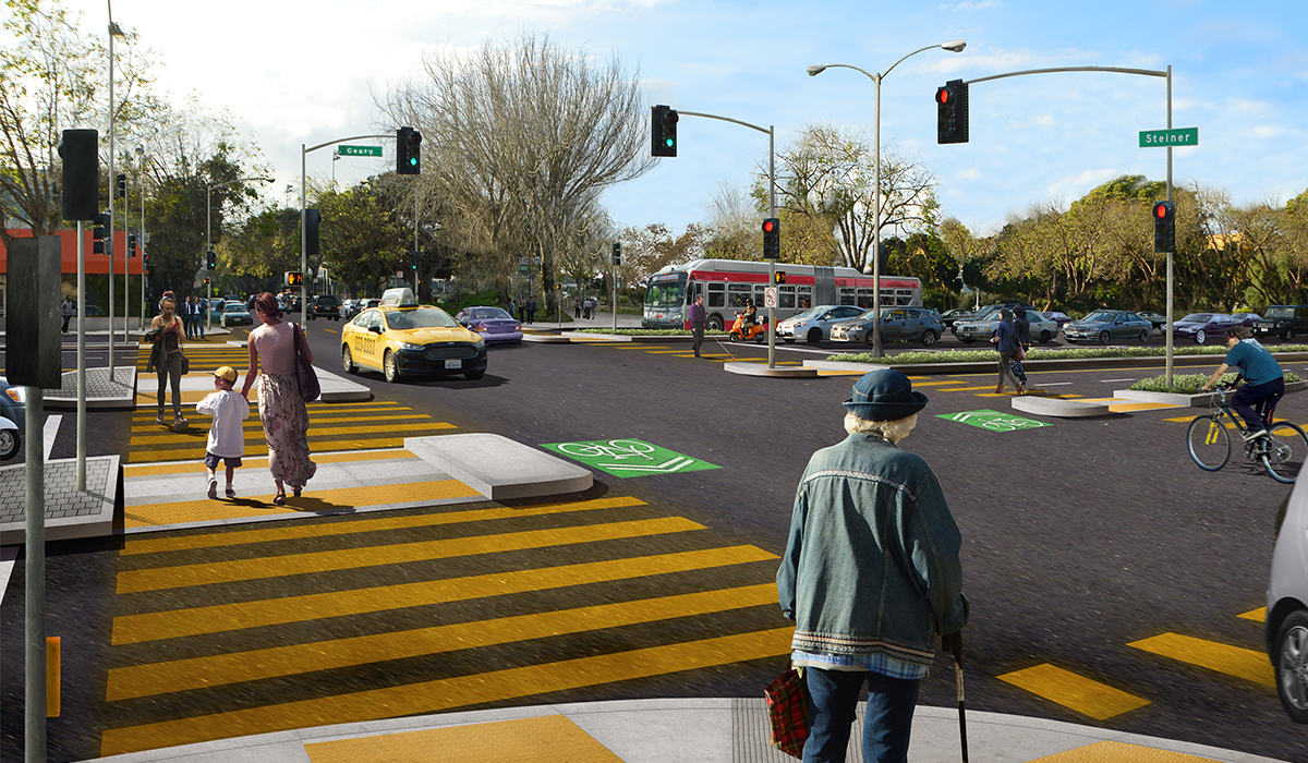
The future of Geary and Steiner, with the Steiner bridge removed and improved crosswalks and medians
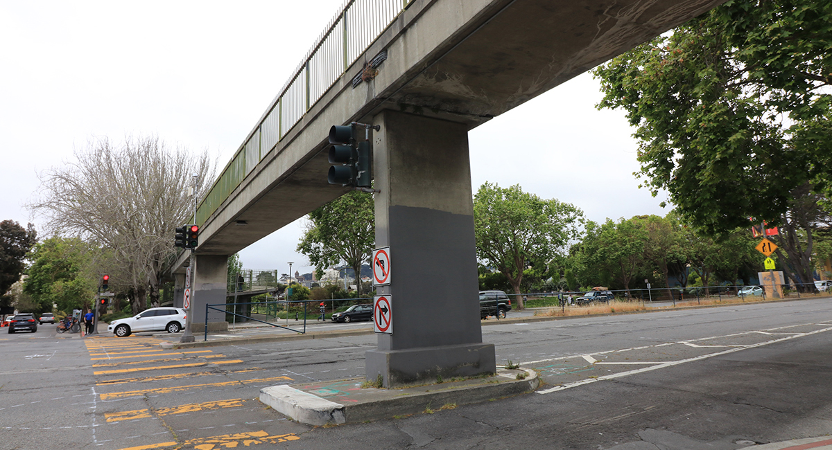
The skyline on Geary Boulevard is about to change: this Memorial Day weekend, the pedestrian overpass at Geary and Steiner will be permanently removed.
Beginning at 8:00 p.m. Friday evening on May 22, the area around Geary Boulevard and Steiner Street will be closed to traffic while crews work to demolish the bridge. Work will continue for 24 hours a day until the demolition is completed, which could continue as late as Monday evening. During that time, vehicles will be rerouted and bus stops will be relocated. If you’re driving or taking Muni in the area, please allow extra travel time to get to your destination.
While removing the overpass may sound like a bridge too far, in this case it’s a bridge too steep. The Steiner pedestrian bridge was built in 1962, with 11-17% ramp slopes that far exceed the 5% limit that was later established by the Americans with Disabilities Act. The bridge’s support piers also reduce visibility of people crossing at the intersection. In place of the overpass, the SFMTA will be improving conditions for how people already prefer to travel—currently, over 80% of people on foot or wheelchair cross Geary and Steiner at street level.
Get info about detours, bus stop changes and more at the Steiner bridge webpage
Later this year, the areas where the bridge ramps were will be repurposed for the adjacent San Francisco Recreation and Park sites. Hamilton Recreation Center will have a new stairway added at the northwest corner of Steiner and Geary, along with an expanded patio and new landscaping. The Raymond Kimbell Playground grassy area will also be expanded including a paved pathway rebuilt towards the intersection.
Towards the end of the project in 2021, after utility upgrades and street repaving are completed, a new surface crosswalk will be added on the east side of the intersection at Steiner. The existing crosswalk on the west side of the intersection will also be improved with larger pedestrian medians.
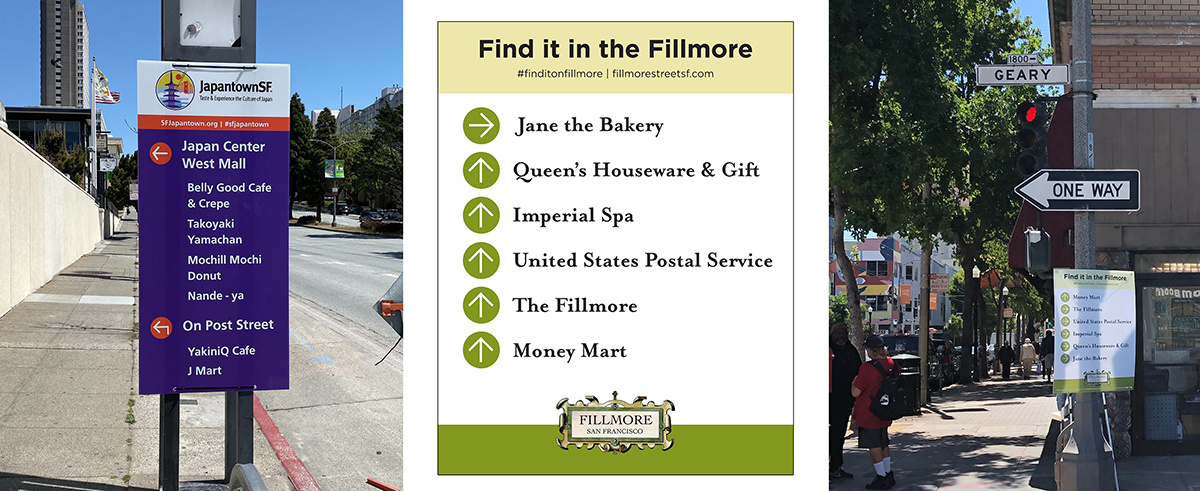
Local businesses and residences will remain accessible during the work, and wayfinding signs are being posted to help small businesses that are still open during the shelter in place order
Those hoping for a spectacle may be disappointed—the bridge won’t be imploded, but instead carefully dismantled and removed by Silicon Valley Demolition using two large five-axle mobile cranes, flatbed trailer trucks, and other large construction equipment.The spiral and folded ramps will be demolished in-place using hydraulic concrete processors to break up the structures; debris will be loaded into dump trucks for transport off-site. Crews are prepared to finish demolishing the bridge over the weekend, rain or shine.
The bridge removal is being overseen by San Francisco Public Works and is part of the Geary Rapid Project, which aims to improve bus service and pedestrian safety on the Geary corridor between Stanyan and Market streets. And it happens to correspond with another milestone—construction of the Geary Rapid Project has just reached its halfway mark and is expected to be completed on schedule in summer 2021.
Reroutes and Bus Stop Relocations
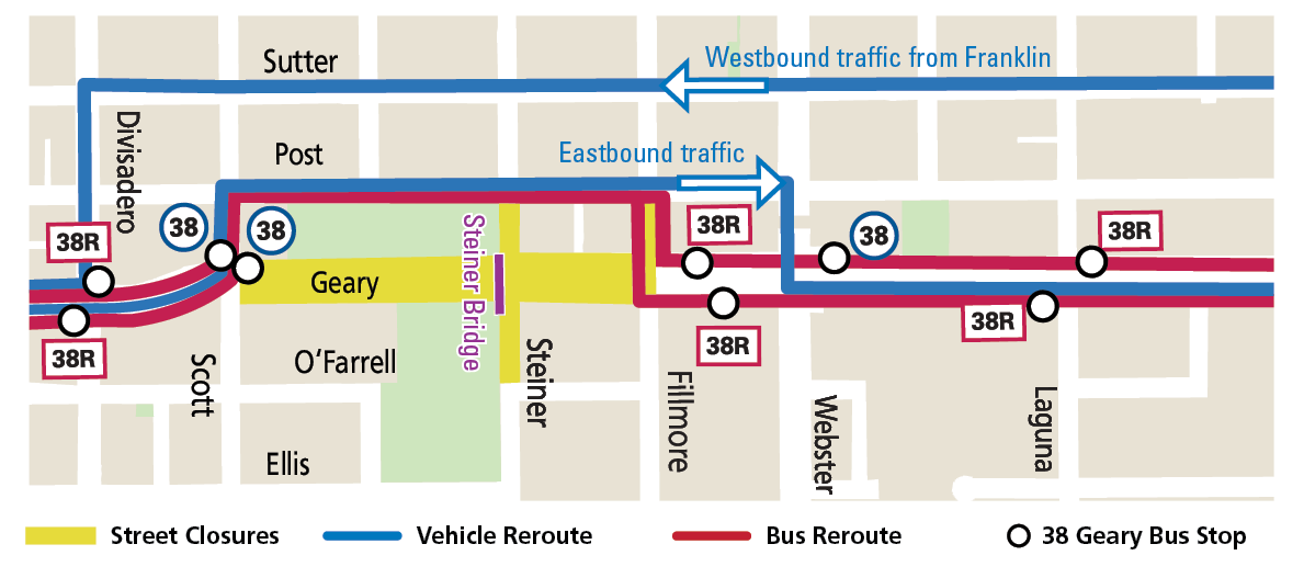
Map of detours and bus stop relocations during the bridge removal that starts Friday evening, May 22
Taking Muni
- 38/38R Geary buses will be rerouted to Post Street around the work zone and some bus stops will be temporarily relocated nearby. Look for “Board Here” signs.
Driving and Parking
- Streets will be temporarily closed to through traffic on Geary between Scott and Fillmore, on Steiner between Post and O’Farrell, and on Fillmore between Geary and Post streets with local access only.
- Vehicles will be rerouted to Sutter Street (westbound) and Post Street (eastbound).
- Some parking will be restricted within the street closure areas, at the relocated bus zones and at intersection corners along the detour route.
Walking or Bicycling
- Pedestrian detours will be provided around the work zone. People crossing Geary Boulevard north/south will need to cross at Scott or Fillmore Street.
- Cyclists can cross Geary at Webster Street.
- The Bay Wheels bike share station at Raymond Kimbell Playground will be closed.
Published May 13, 2020 at 02:39AM
https://ift.tt/35W5UcV
Comments
Post a Comment