By Adrienne Heim
Lake Merced is a popular recreational destination
Help Us Prioritize and Identify Needed Safety Improvements
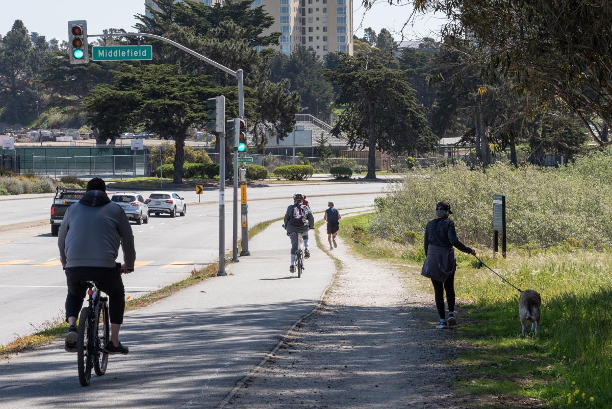
The Lake Merced Pedestrian Safety Project is studying potential improvements for pedestrian safety and access along Lake Merced Boulevard between Sunset Boulevard and John Muir Drive. Situated in San Francisco’s southwestern corner, Lake Merced Boulevard has a history of collisions, including those between vehicles and pedestrians, and between vehicles and bicycles. Lake Merced Boulevard between Font and Sunset boulevards is part of San Francisco's Vision Zero High Injury Network (HIN), where 75% of the city's traffic injuries and fatalities occur on just 13% of its streets.
Surrounded by major recreational, education, and shopping destinations, the boulevard is a major route for Lake Merced Park, San Francisco State University, Lowell High School, Lakeshore Elementary School and Stonestown Galleria. Lake Merced Boulevard is also an official city bicycle route where cyclists can either use the bike path around the lake or share the roadway with drivers on the north side of the street.
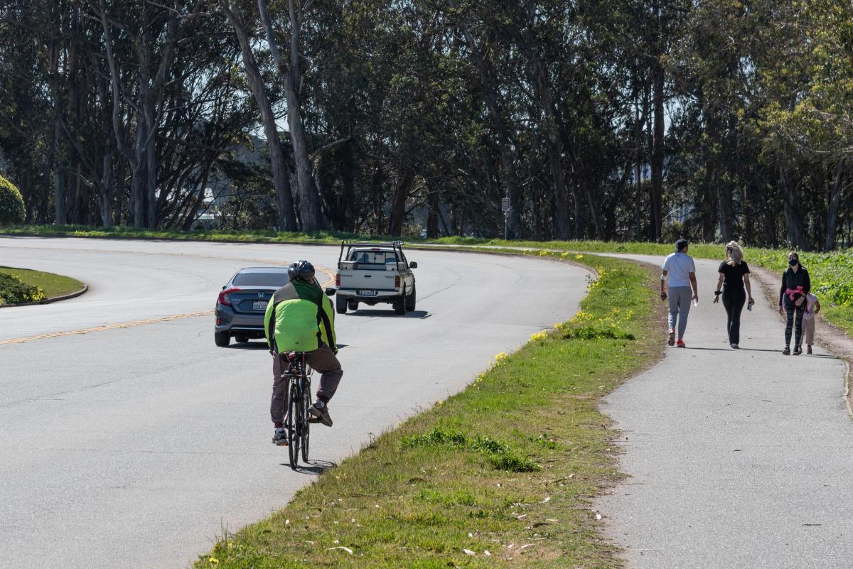
People walking and biking on Lake Merced Boulevard
Over a 5-year period (between 2015 to 2020) a total of 106 collisions were reported on the boulevard between Skyline Boulevard and John Muir Drive. Of those, nine were bicycle-vehicle collisions and four were vehicle-pedestrian collisions.
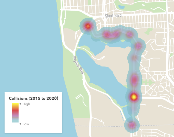
Vehicle, Bicycle and Pedestrian Collisions from 2015 to 2020 on Lake Merced Boulevard from Skyline Boulevard to John Muir Drive
Participate in Our Virtual Open House
From June 8 to June 22, we are inviting feedback from community members who live, work, and/or travel around Lake Merced Boulevard through our interactive virtual open house (available in English, Chinese and Spanish). You can learn more about the project and provide comments during the event, which can be accessed at any time during the open house period.
In July, we will review the steering committee and community’s feedback and produce a Community-Based Transportation Plan (CBTP) that highlights recommendations for improvements, preliminary conceptual designs, and a feasible implementation plan that reflects community needs and desires.
We also encourage you to take the Lake Merced Pedestrian Safety Survey on the website or by placing your cell phone camera over the QR code.

The survey will be open until June 22.
The planning process for this project includes a monthly steering committee that consists of neighbors and stakeholders to help staff better understand current walking patterns, barriers, and opportunities to improve pedestrian connections to and from Lake Merced Park and nearby transit stops. Learn more about the project and subscribe to project updates by visiting our Lake Merced Pedestrian Safety Project, Making Access Around Lake Merced Safer and More Pleasant website.
Published June 08, 2021 at 10:17PM
https://ift.tt/3g1nymk
Comments
Post a Comment